Forest edges near farms enhance wheat productivity measures; a test using high spatial resolution remote sensing of smallholder farms in Southern Ethiopia

Abstract
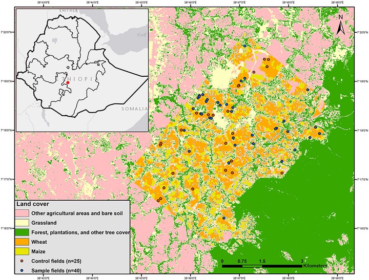
Staple crops are grown by millions of smallholder farmers yet estimating field-level yields over broad regions can be challenging. Furthermore, agricultural productivity can be impacted by nearby forests and trees. In an agricultural-forest mosaic in Southern Ethiopia, we used remote sensing imagery to identify and differentiate among dominant crops and assess the impact of nearby forest patches on wheat productivity. Using a suite of vegetation indices (VIs) derived from high spatial resolution (5-10 m) satellite imagery as a proxy for wheat productivity, we determined whether VIs were enhanced or suppressed with increasing distance to forest. We found that 5-10 m resolution satellite imagery was sufficient for identifying and differentiating among field boundaries and dominant crops, however, imagery from higher spatial resolution satellites would see increased benefits in accuracy. VIs increased by as much as 5% in areas of the fields within 30 m of forest edges compared to fields further from forests. Our results highlight potential benefits of a landscape approach for enhancing smallholder agricultural productivity in Southern Ethiopia. High spatial resolution imagery is a cost-effective method to map and identify promising landscape approaches in agricultural-forest mosaics dominated by smallholder farms. Thus, a landscape perspective aided by remote-sensing can provide a straightforward and cost-effective way to monitor crop productivity and track changes in agricultural productivity due to forest fragmentation and/or restoration. A landscape approach to achieving food security goals, particularly within the context of climate considerations, and should play a more prominent role in planning forest conservation and restoration.